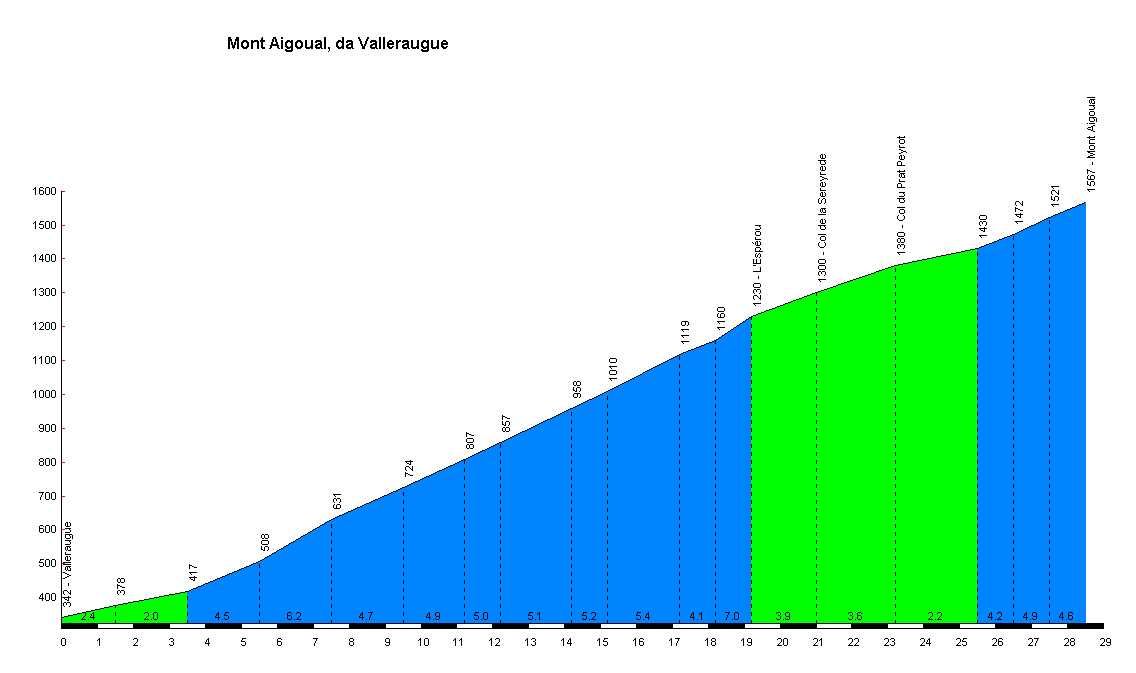
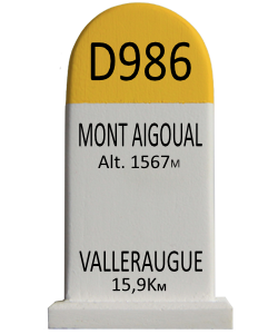
Mont Aigoual - Valleraugue
Mont Aigoual
| Mont Aigoual | |
|---|---|

East face of Mont Aigoual
|
|
| Highest point | |
| Elevation | 1,567 m (5,141 ft) |
| Prominence | 730 m (2,400 ft) |
| Coordinates | 44°07′22″N 3°34′30″ECoordinates: 44°07′22″N 3°34′30″E |
| Geography | |
| Location | |
| Parent range | Massif Central |


Mont Aigoual (Occitan: Mont Augal, elevation 1567m / 5141 ft) is the highest point of the Gard département, France. It is part of the Massif Central, and it is located within the Cévennes National Park. Its southern slopes are the source of the river Hérault flowing into the Mediterranean.
When the sky is clear, it is possible to see the Mediterranean Sea, the Pyrenees, and also the Alps and Mont Blanc in particular. The summit is accessible by car from a variety of converging surfaced approaches.
Tour de France
The col de Mont Aigoual (1507 metres) has been used once by the Tour de France. In 1987 Silvano Montini (Italy) was first over the summit.[4]
The Rider by Tim Krabbé
The Tour of Mont Aigoual is the semi-fictional cycle race in the book The Rider by Tim Krabbé.
The race is recreated on the Rapha[5] and on the inrng[6] weblogs