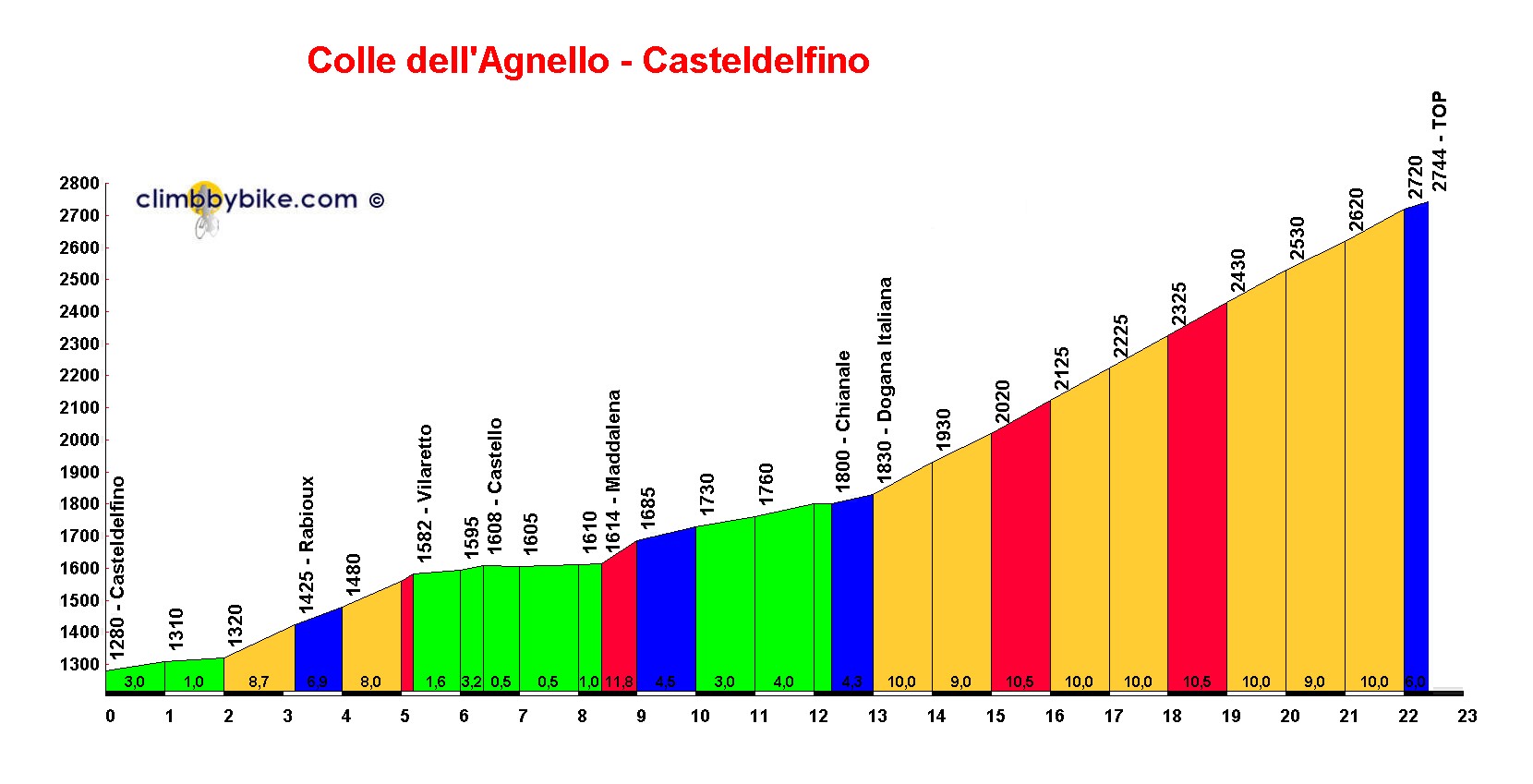
Colle dell'Agnello - Casteldelfino
Col Agnel
| Col Agnel | |
|---|---|
 |
|
| Elevation | 2,744 m (9,003 ft) |
| Traversed by | D205 / SP251 |
| Location | Hautes-Alpes, France Province of Cuneo, Italy |
| Range | Cottian Alps |
| Coordinates | 44°41′2″N 06°58′46″ECoordinates: 44°41′2″N 06°58′46″E |

Col Agnel
|
|

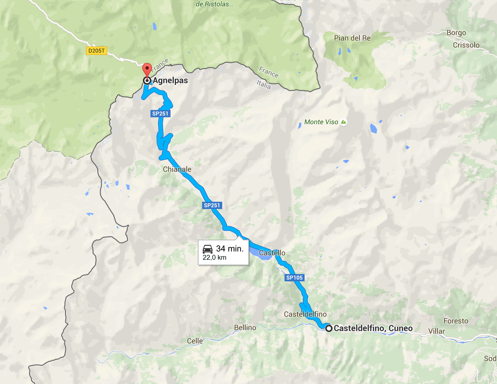
Col Agnel (Italian: Colle dell'Agnello) is a mountain pass in the Cottian Alps, west of Monte Viso between France and Italy which links the Queyras valley (Hautes-Alpes) with Pontechianale in the province of Cuneo, Piedmont.
At 2,744 m (9,003 ft), it is the third highest paved road pass of the Alps, after Stelvio Pass and Col de l'Iseran.
Despite being the highest international pass of the Alps,[1] Col Agnel is somewhat unknown and not heavily used. It is one of the many passes suggested as the route taken by Hannibal in his march, with elephants, to attack Rome at the start of the Second Punic War and a modern-era plaque, mounted on a rock on the French side, commemorates the event.[2]
Cycling
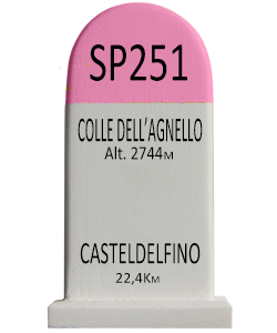
From Château-Queyras (France), the climb is 20.5 km long at an average gradient of 6.6%. From Casteldelfino (Italy), the climb is 22.4 km long at an average gradient of 6.5%.
Tour de France
The Col Agnel was crossed for the first time on 20 July 2008 during stage 15 of the 2008 Tour de France. The Col Agnel was crossed for the Second Time on 21 July 2011 during Stage 18 of The 2011 Tour de France.
| Year | Stage | Category | Start | Finish | Leader at the summit |
|---|---|---|---|---|---|
| 2011 | 18 | Hors Categorie | Pinerolo | Serre-Chevalier | |
| 2008 | 15 | Hors Categorie | Embrun | Prato Nevoso |
Giro d'Italia
The Col Agnel was crossed on 24 May 2007 during stage 12 of the 2007 Giro d'Italia.
| Year | Stage | Category | Start | Finish | Leader at the summit |
|---|---|---|---|---|---|
| 2007 | 12 | 1 | Scalenghe | Briançon |