xYour article is added to your cart Click here to go immediately to your cart.
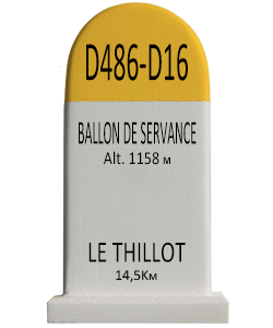
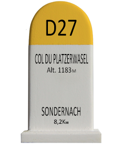
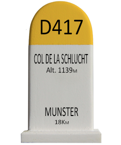
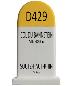
Click here if you want an engraved road marker (+ 7€)
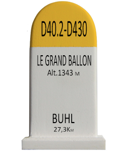
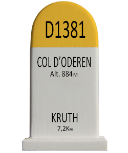
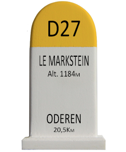
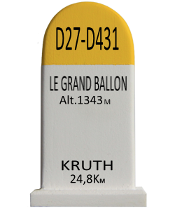
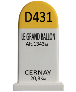
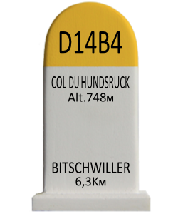
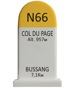
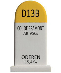
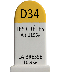
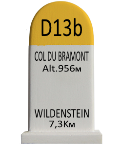
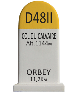
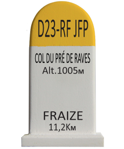
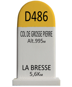
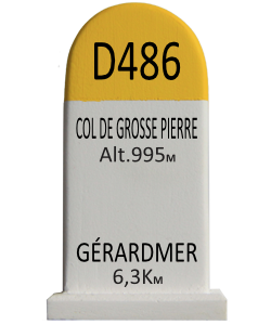
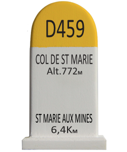
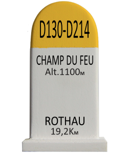
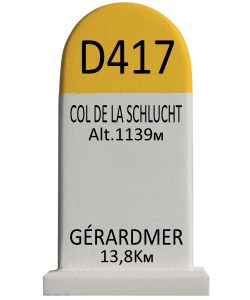
The Col de la Schlucht (elevation 1,139 m (3,737 ft)) is a mountain pass in the Vosges Mountains of France. The pass takes its name from the German word "Schlucht", meaning "gorge" or "ravine". It connects Munster (Haut-Rhin) with Gérardmer (Vosges) (east – west) and is also crossed by the Route des Crêtes (north – south). The climb over the pass has been used several times in the Tour de France cycle race.
9 €
…