Coll de la Gallina – St Julia de Loria
€ 9,00
Description
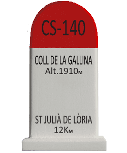
The Collada de la Gallina is a mountain road in the Pyrenees in Andorra, in the parish of Sant Julià de Lòria, reaching an altitude of 1,907 m[1]. From Aixovall, the climb is 11.8 km long and has an average gradient of 8.3%, with stretches reaching 11%. The positive elevation gain is 980 m[1]. From Sant Julià de Lòria, the climb is 12 km long and has an average gradient of 8.4%, with stretches reaching 13%. The total ascent is 1,018 m[1]. The Collada de la Gallina is part of the CS-111 route. The climb has been used several times by the Tour of Spain. Source Wikipedia
Additional Info
| Weight | 0,120 kg |
|---|---|
| Dimensions | 3,6 × 2,4 × 7,5 cm |
| Weight | 0.120 kg |
| Dimensions | W 43mm x D 34mm x H 77mm |